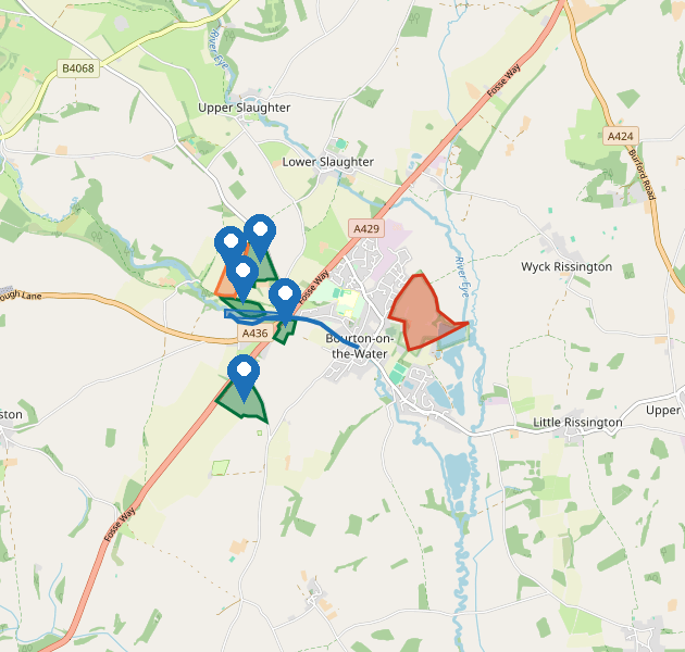
The image of the map uses the same colours as the interactive map. Green is available. Orange is already in an agreement. Blue is the river buffer. Red is the SSSI.
| On the map | What it shows |
|---|---|
| Green filled area with a green outline | A land parcel that is available to select for this application. These are Fosse Field, West Park, North Field and Station Meadow, west and north of the village. |
| Orange filled area with an orange outline | Lansdowne Ground. This parcel is already in a Countryside Stewardship agreement until 30 September 2028, so you cannot add it to a new SFI application yet. |
| Blue strip and blue line | The River Windrush and a 6 metre buffer drawn along its north bank, next to West Park. You must keep this buffer. It is eligible for a watercourse action but not for arable actions. |
| Red hatched area with a red outline | Salmonsbury Meadows Site of Special Scientific Interest, part of Greystones Farm nature reserve, immediately east of the village. It is not on this holding and you cannot claim on it. |