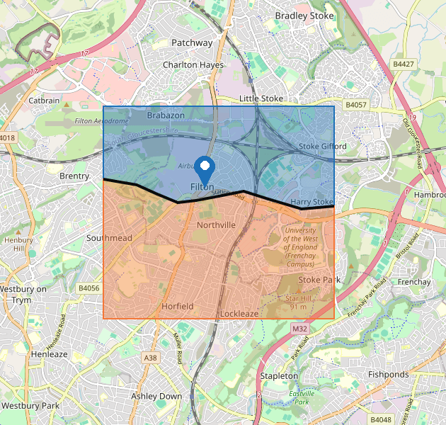
The image of the map uses the same colours as the interactive map. Blue is South Gloucestershire. Orange is Bristol. The black line is the boundary.
| On the map | What it shows |
|---|---|
| Blue area with a blue outline | South Gloucestershire. This is the local authority for 400 Filton Avenue. It covers Filton, Patchway, Bradley Stoke and land north of the black boundary line. |
| Orange area with an orange outline | Bristol City Council. This is the neighbouring authority. It covers Horfield, Lockleaze and land south of the black boundary line. |
| Black line | The boundary between South Gloucestershire and Bristol. It crosses Filton Avenue west of this property, then continues towards the M32. |
| Pin labelled 400 Filton Avenue | The property this search is for. It stands on the north side of Filton Avenue, inside South Gloucestershire. |