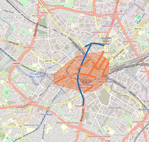
The image of the map uses the same colours as the interactive map. Orange roads are the ones changing. Blue roads are the A38.
| On the map | What it shows |
|---|---|
| Orange shaded area with an orange outline | The proposed 20mph zone covering central Birmingham, including New Street, Corporation Street, Broad Street, Colmore Row and the streets around the Bullring. |
| Orange line | A road where the speed limit would change from 30mph to 20mph. These are the highlighted roads on both the interactive map and the static image. |
| Blue line | A strategically important route on the A38 Queensway. The speed limit would stay at 30mph so through-traffic can still use the inner ring road. |